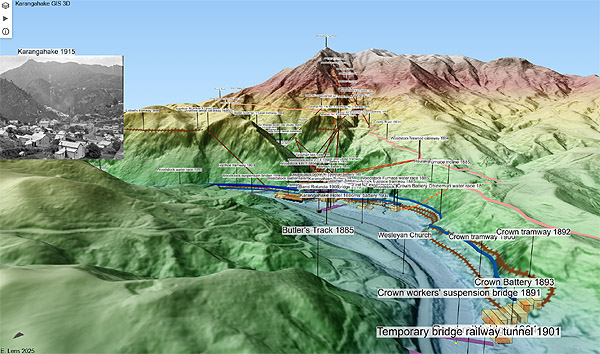
A 3D terrain model of Karangahake and infrastructure (1886 to 1933 inclusive).
Allow a moment for it to load. Use your mouse buttons to navigate. Clicking the play button top left will set off an animation :)
Many items are clickable, providing extra information.
Also available is the flat GIS which allows filtering for feature or company, and for various date sequences.